Tag: Beijign capital city (China)*
-
Major Chinese Battles along the Yellow and Yangtze River, 1920-1940s
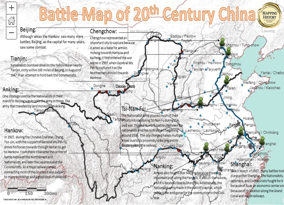
ElyaDatabase ID Number: M190 Creator: Katherine McKendrick ’19 Environmental Studies
-
SARS in China 2003
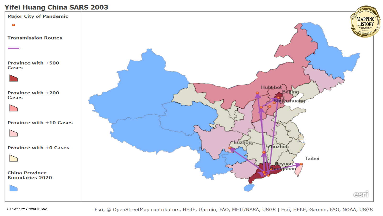
ElyaDatabase ID Number: M176 Creator: Yifeng Huang ’22 Optics These are the maps that show the total infected and the transmission routes of the SARS in China in the year of 2003 till May. The major cities of SARS pandemic were mainly concentrated in Guangdong province and then spread to the whole country. The graph on…
-
China Car Industries
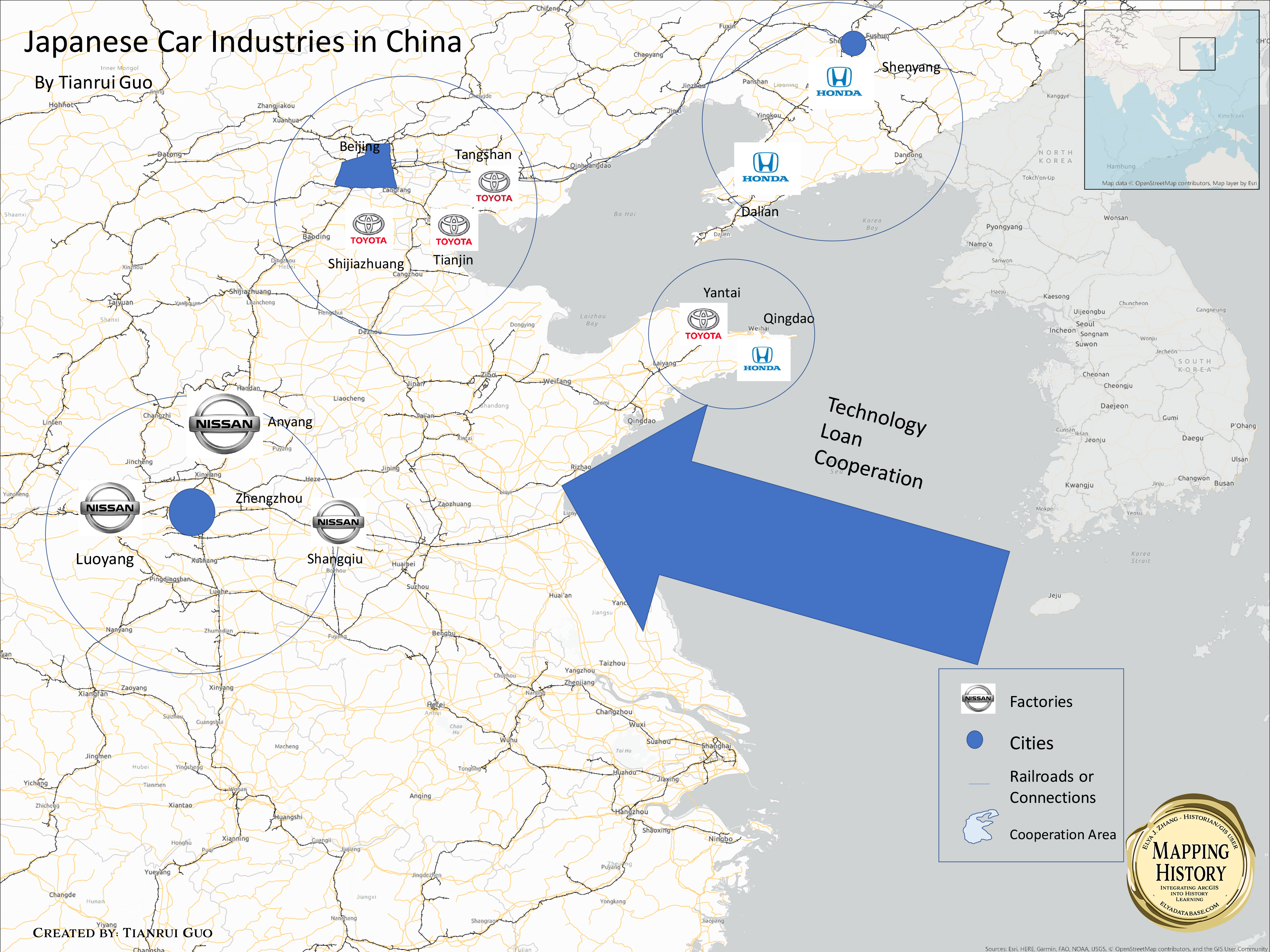
ElyaDatabase ID Number: M159 Creator: Tianrui Guo ’20 Applied Mathematics This map basically shows the Chinese-Japanese joint venture in Car Industries. In these 3 circles in inter-China, the Japanese car business such as Toyota, Nissan and Honda have established their own joint venture around these 3 major cities in Beijing, Shanghai and Shenyang. The joint…
-
HSR in China (2020)

ElyaDatabase ID Number: M091 Creator: Monica Yile Hu ’21 Mathematics The 2010s is a golden era for China’s high-speed rail development. The mileage of high-speed rail has exceeded 35,000 kilometers. Two maps show the rapid development of high-speed rail in the past decade. In 2020, the High-Speed Rail has reached north to Harbin, South to…
-
Shi Jiazhang and Its Strategic Location

ElyaDatabase ID Number: M085 Creator: Tianyao Zhao ’19 Environmental Health Once merely a small village located in the north China, Shijiazhuang’s fate vastly changed after becoming the interception point of two of the earliest railway in China, the Jing-Han line and Zheng-Tai line. Coal was carried on the trains, and factories were built along the…
-
The Qinghai-Tibet Railway

ElyaDatabase ID Number: M079 Creator: Junting Chen ’22 Interdepartmental Program This map shows how the major sightseeing points are situated along the Qinghai-Tibet railway and other roads in Qinghai province and Tibet Autonomy Region. Overall, the map elaborates the Qinghai-Tibet railway serves as the main entrance for the outsiders who want to go to Tibet.…
-
Transportation of Clocks from Europe to Eastern China via Matteo Ricci
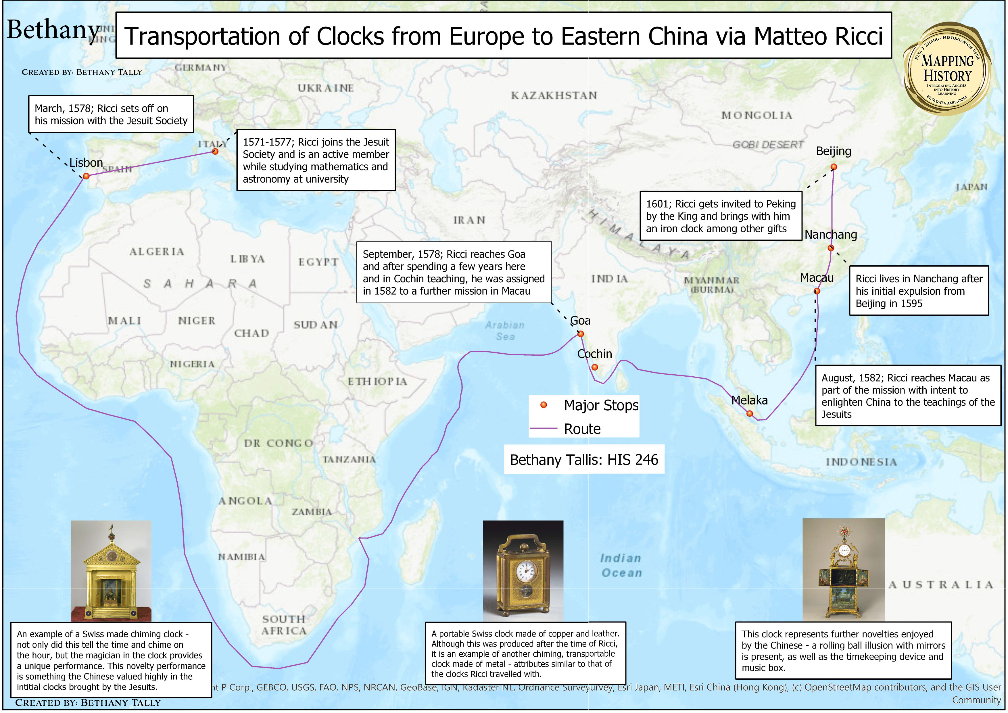
ElyaDatabase ID Number: M049 Creator: Bethany Tallis ’20 Environmental Studies
