ElyaDatabase ID Number: M176
Creator: Yifeng Huang ’22 Optics
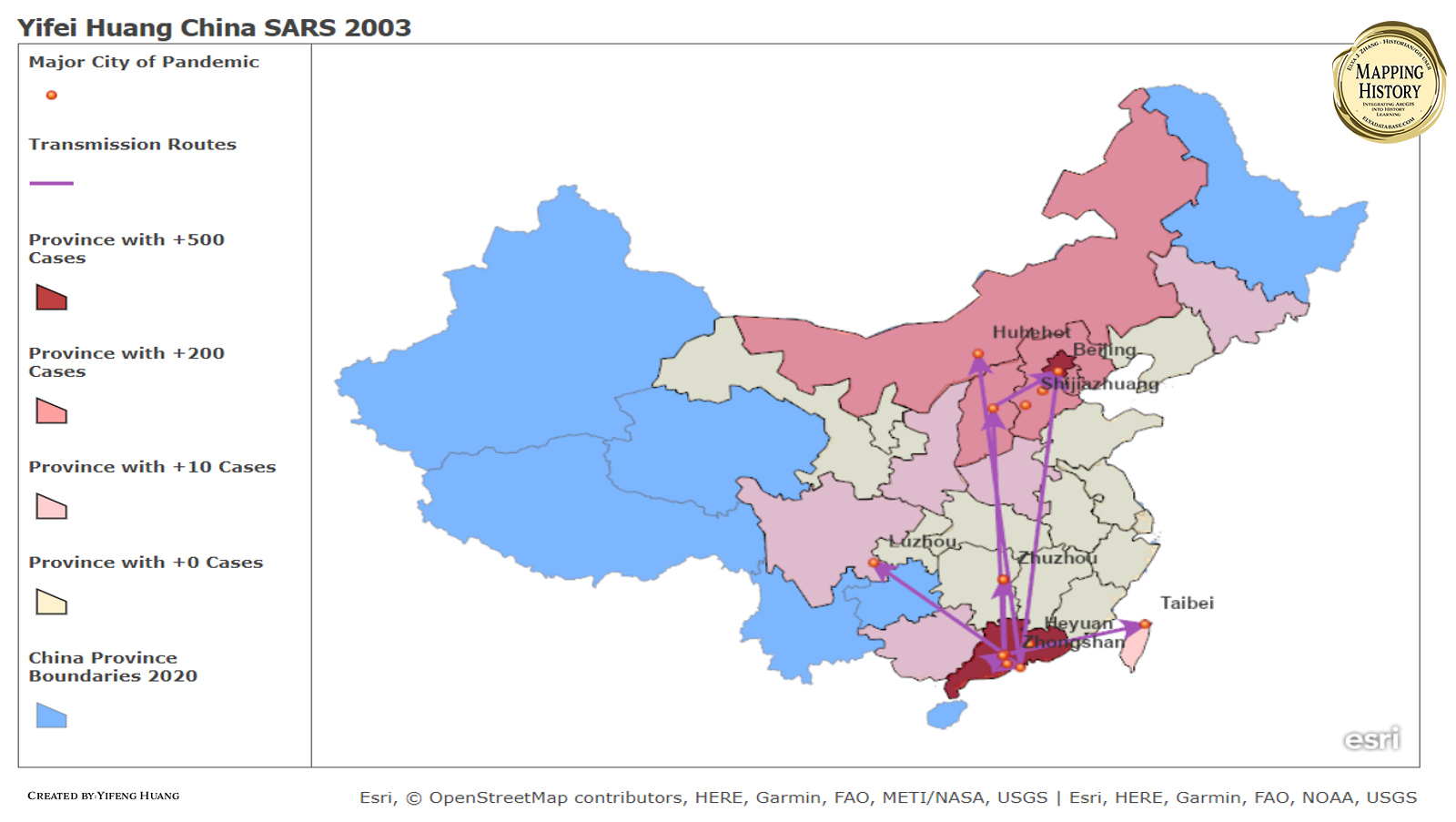
These are the maps that show the total infected and the transmission routes of the SARS in China in the year of 2003 till May. The major cities of SARS pandemic were mainly concentrated in Guangdong province and then spread to the whole country. The graph on the below shows the specific route of transmission in Guangdong province with exactly date. However, for some of the city I did not find the sources that discuss how did the virus spread to these cities, so I just leave it without transmission route since I have no enough information. We can find that the SARS virus spread radially from Guangdong province where is the origin of the SARS. Another region that has the most cases, except the Guangdong province, is Beijing. And the reasons might be pretty obvious, Beijing is the capital city of China, and it is also the center of Chinese culture and the center of transportation junction. Also, Beijing is city that has the most population in China. Thus, these factors preordained Beijing would be another center of the pandemic.
Cite This Work :
Yifeng Huang, “SARS in China 2003.” Scale: 1:70,000. In Elya J. Zhang, ed., Mapping History Series. <https://elyadatabase.com/2022/06/12/yifei-huang-china-sars-2003/> (accessed May 27, 2022).
Leave a Reply