Tag: United States*
-
Railways and Immigration, 1865-1914

ElyaDatabase ID Number: M090 Creator: John Fowell ’20 Geology As immigrants arrived in the United States looking for a new life, they used the railways to travel west into the American continent. They arrived in East Coast cities, like New York and Boston and headed into the Great Lakes and Midwest to places like Buffalo,…
-
Gauge Wars on the Grand Trunk 1860

ElyaDatabase ID Number: M087 Creator: Charles Gould ’21 History & Environmental Science
-
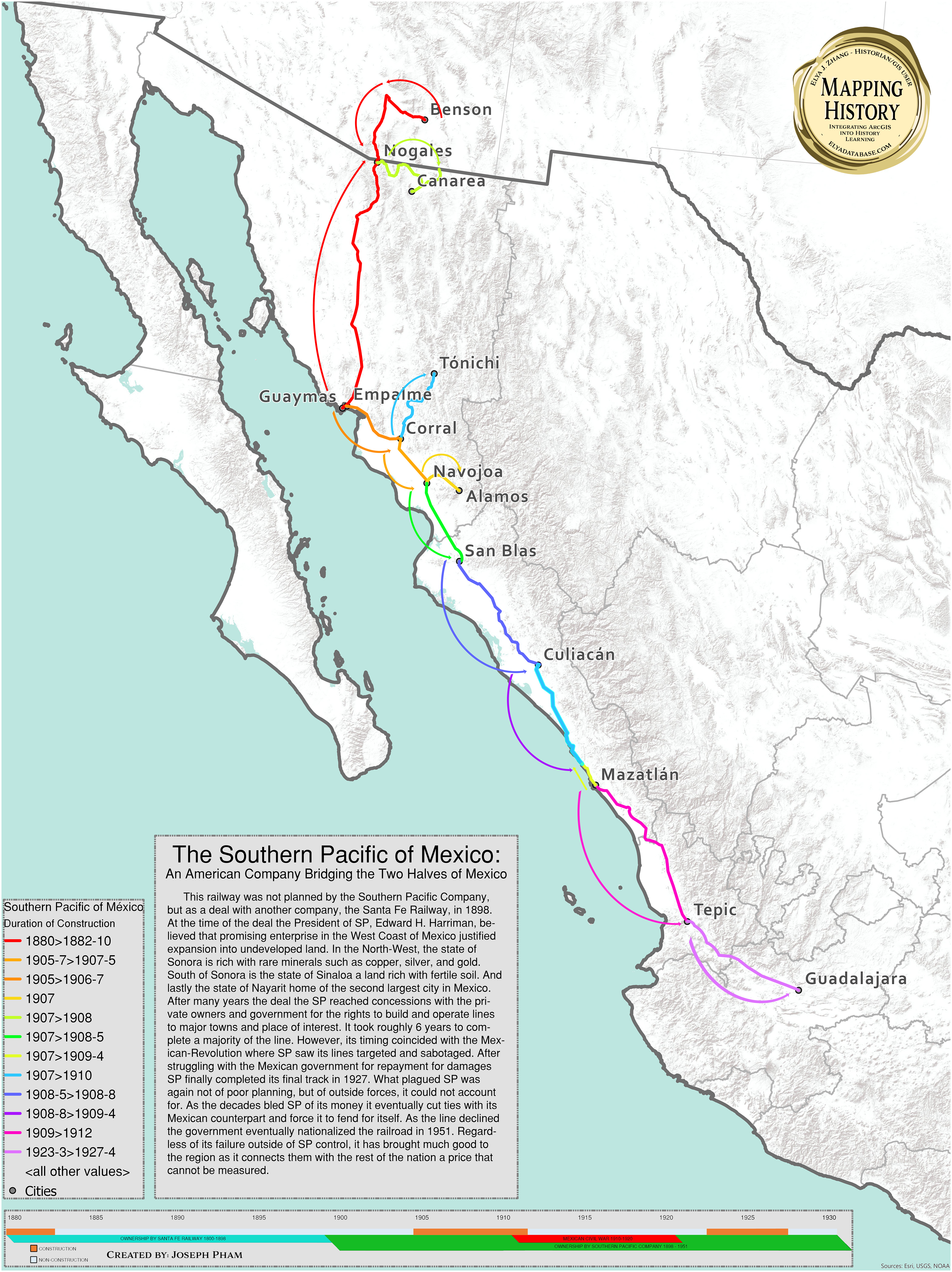
The Atchison, Topeka, and Santa Fe Railroad

ElyaDatabase ID Number: M081 Creator: Matthew Delsordo ’19 Computer Science
-
Foreign Built Railways in China

ElyaDatabase ID Number: M077 Creator: Andrew Lee ’19 Chemistry At the start of the 1900s, there was a scramble to build railroads in imperial China by the major European powers to earn money, gain provisional control, and extract riches from the surrounding areas. This model proved incredibly successful for the British and Germans, with their…
-
Cooperation Between the Philippines and China in B&R

ElyaDatabase ID Number: M031 Creator: Zirui Li This map depicts the major Chinese infrastructure investment in the Philippines. The investments have expanded to various cities and various industries. There are two oil joint development areas. This map also shows the political stability of different provinces which indirectly reflects the stability of the investment projects there.…
-
Principle French and English Settlements and Fur Trading Territories 1665 – 1755

ElyaDatabase ID Number: M005 Creator: Sophia McRae ’19 History These maps portray two major phases of the North American fur trade up to 1755. The first map captures the earliest settlements and exploration of the east coast of North America by the mercantile powers of England, France, Sweden, and the Netherlands. The largest portion of…