Category: The Greater East Asia Co-Prosperity Sphere*
-
Manchuria The 1931/32 Invasion

ElyaDatabase ID Number: M157 Creator: Matthew Wheeler ’21 History This map shows the Japanese invasion of Manchuria. The map shows how far the Japanese went into Manchuria from 1931 to 1932. Japan held Korea before the invasion, took half during 1931, and took all of it during 1932. After Japan took over they created a…
-
Manchuria Heavy Industries

ElyaDatabase ID Number: M156 Creator: Ziwei Liu ’23 Business This map shows two major influence of the northeastern China Japan put on after the invasion. One is heavy industrial, the other one is railways construction. The northeastern China was made a base of Pacific War by Japan because of abundant raw materials, especially the minerals.…
-
South Korea Undersea Tunnel
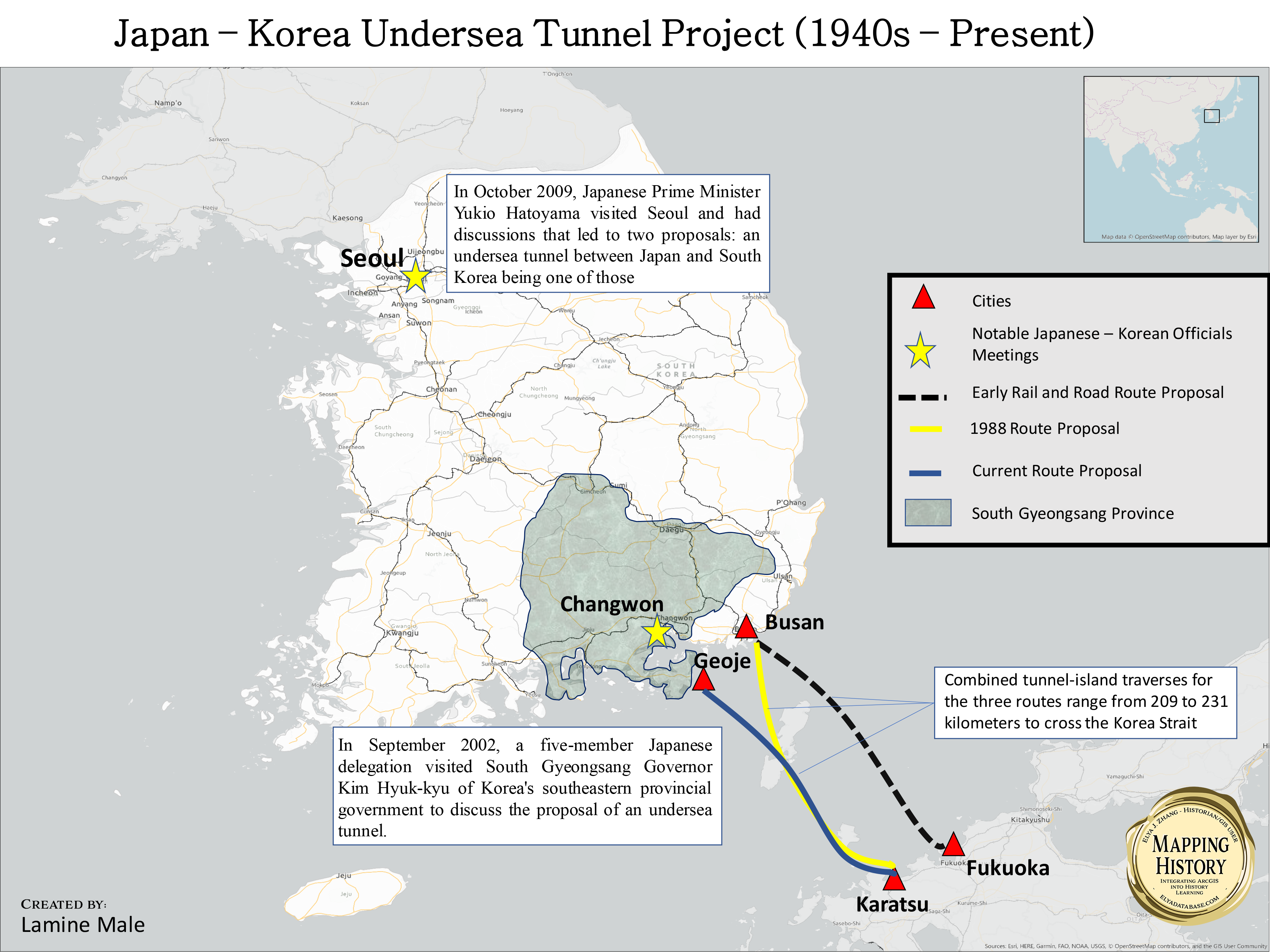
ElyaDatabase ID Number: M155 Creator: Lamine Male ’21 Computer Science This map is about the Japan-Korea Undersea Tunnel Project. It shows in different colors and formats the different routes that have been proposed from the 1940s until recent times. The earliest routes proposed include a rail and road trajectory that would link Busan to Fukuoka…
-
South Korea Cultural Merging

ElyaDatabase ID Number: M154 Creator: Nicholas Angelin ’21 Japanese Studies At the Convention and Exhibition Center in Seoul of 2019, the yearly Korea-Japanese festival was held to continue the celebration of the nations peaceful relations. Going strong since 2005, the festival is held in both Seoul and Tokyo to share the unique cuisines, clothing, traditions,…
-
South Korea Education and Religion
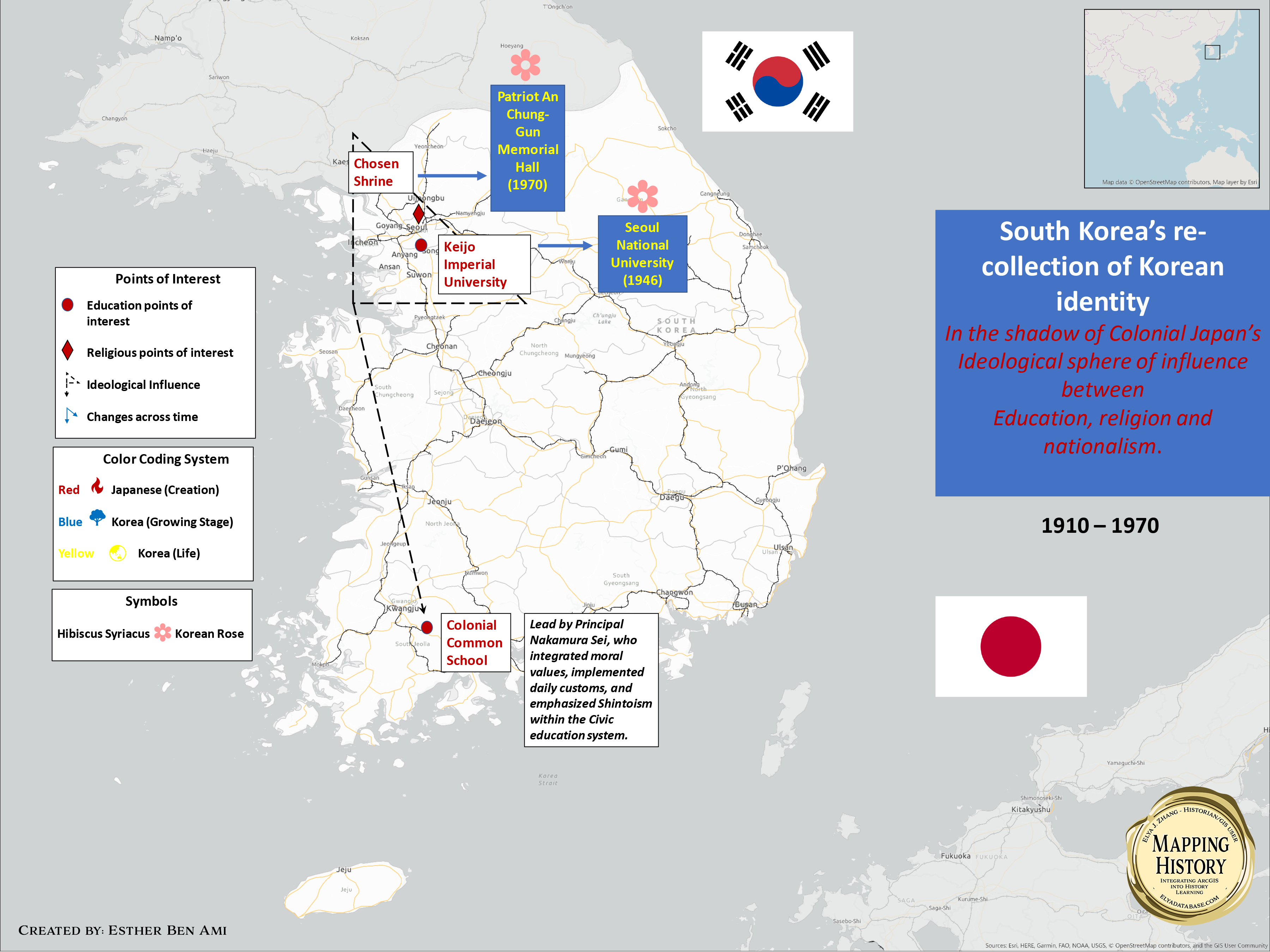
ElyaDatabase ID Number: M153 Creator: Esther Ben Ami ’22 Psychology From 1910-1945, the Japanese colonial administration in the Korean peninsula concentrated their sphere of influence between education and religious institutions. During Japanese occupation, Shinto shrines were built all over the Korean Peninsula. Along with the physical presence of Shinto shrines, Shintoism interacted with the school…
-
Philippines Economic Influence II

ElyaDatabase ID Number: M152 Creator: Gabriel Lundy ’23 Mechanical Engineering This map portrays the major Chinese investment and economic relations in the Philippines from 1965-2019. Chinese owned industries have spread to several cities, especially Manila. There are three major rivers and four mining zones, which positively affect the methods of transportation and gathering of resources…
-
Philippines Defense Cooperation
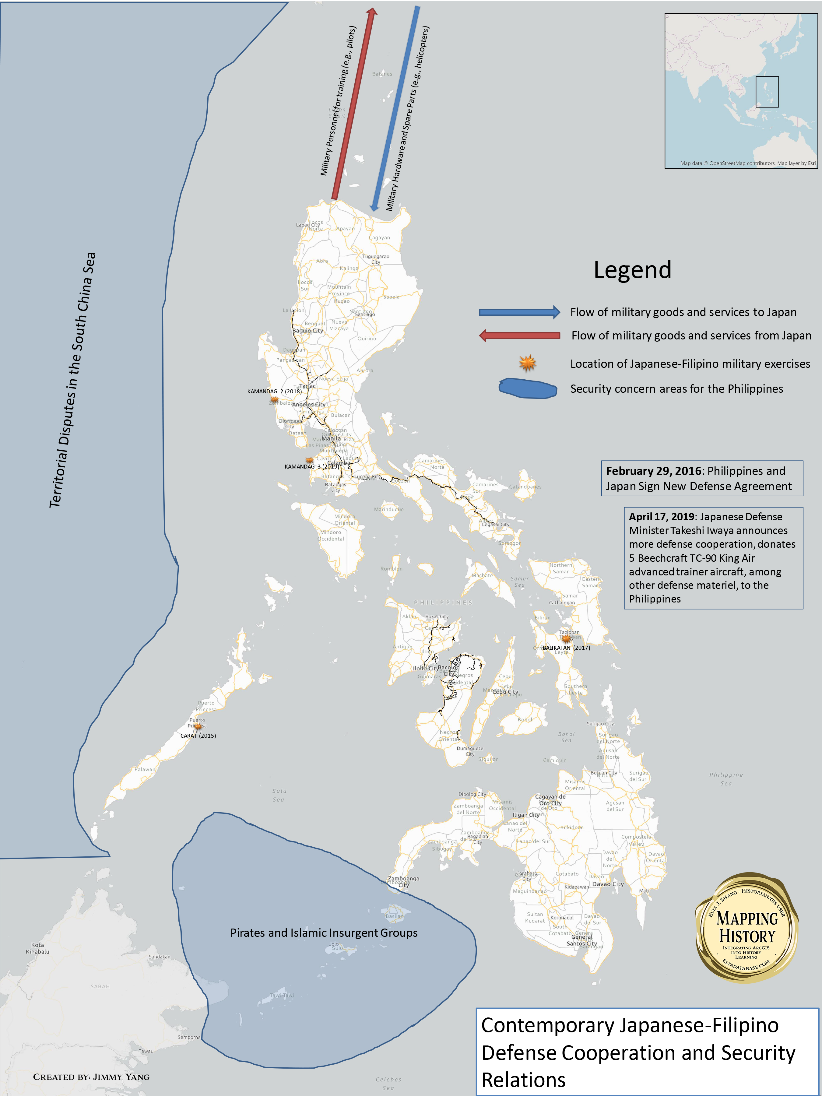
ElyaDatabase ID Number: M151 Creator: Jimmy Yang ’20 Economics In the 21st Century, Japan has taken a more proactive role in defense cooperation and security relations with US partners. JSDF personnel have been deployed overseas to countries like the Philippines, where they train in military exercises in conjunction with US and Filipino forces. Japan also…
-
Philippines Economic Influence
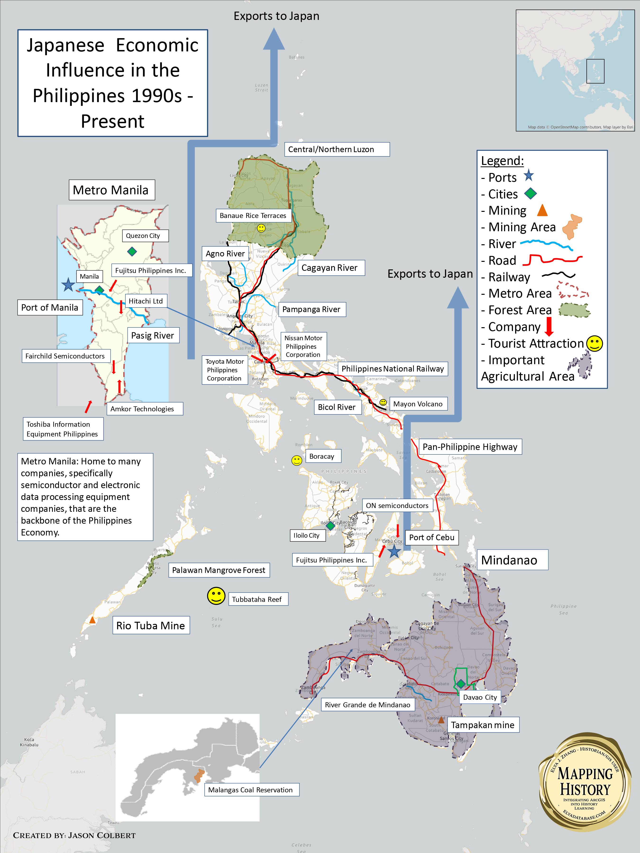
ElyaDatabase ID Number: M150 Creator: Jason Cobert ’23 Undecided The Philippines, while only directly occupied by Japan for 3 years during the period between the bombing of pearl harbor and the surrender of Japan, have been immensely influenced economically by trade with Japan as well as implementation of Japanese business in the Philippines. The main…
-
China ODA

ElyaDatabase ID Number: M149 Creator: Ning Wang ’19 Electrical and Computer Engineering The map shows two large-scale economic infrastructure construction projects funded by Japan’s Official Development Assistance loans during 1990s, Qinghuangdao Port construction project and Datong – Qinhuangdao Railways construction project. The completion of the two projects enabled a more efficient coal transportation from inland…
-
Indonesia Industrial Influence

ElyaDatabase ID Number: M148 Creator: Ian Ono-Gerow ’21 East Asian Studies This map shows the major industrial sites that signify the strong connections between Japan and Indonesia after 1958. The different factory marks around the map show areas that have multiple factories concentrated. The airplane marks show the areas that are strong in the tourist…